
The geological process that creates Alberta’s hoodoos—differential erosion—is the very same one that ensures their destruction, a process now dangerously accelerated by human activity.
- Hoodoos are not static; they are temporary structures formed when soft sandstone erodes faster than its hard ironstone caprock.
- Their lifespan is being dramatically shortened by anthropic pressure, from off-trail foot traffic to environmental changes.
Recommendation: To preserve these formations, visitors must shift from passive sightseeing to active stewardship, understanding that every step has a geological consequence.
The badlands of Alberta present a landscape that feels alien and ancient. Dominating this vista are the hoodoos, strange sandstone pillars that stand like silent sentinels in the coulees. For many curious travelers, they are simply a bizarre photo opportunity. But to view them as mere rock sculptures is to miss their dynamic and urgent story. These formations are not static monuments; they are active geological narratives written in layers of Cretaceous sandstone and shale, detailing a constant, delicate battle between resistance and erosion.
The common understanding is that wind and water carve them over millions of years, which is true, but incomplete. This oversimplification masks the precise mechanism of differential erosion—the core concept that explains both their birth and their demise. The survival of each hoodoo depends entirely on its protective caprock, a harder layer of ironstone that shields the softer sandstone beneath it. This article moves beyond the surface-level platitudes to explore the intricate geomorphology of hoodoo formation.
Our purpose here is to reframe your perspective. By understanding the science of their creation, the cultural significance they hold for Indigenous peoples like the Blackfoot, and the fragility that defines their existence, we can transform from simple tourists into informed custodians. We will examine the specific forces at play, from water infiltration to cryofracturing, and reveal why their disappearance is not a distant threat but an ongoing process that our actions can accelerate. This guide provides the knowledge needed to appreciate and, more importantly, to help preserve these ephemeral wonders of the Alberta landscape.
This comprehensive exploration will guide you through the key aspects of experiencing Alberta’s hoodoos, from understanding the strict rules of preservation and the cultural importance of these sites, to practical advice for visiting them across different seasons and locations. The following sections provide the essential context for a respectful and scientifically informed visit.
Summary: The Complete Geological and Cultural Guide to Alberta’s Hoodoos
- The Protected Zone vs The Wild: Where Can You Walk Near Hoodoos?
- Morning Light or Evening Shadows: When Do Hoodoos Look Most Dramatic?
- Blackfoot Legends: What Do Hoodoos Represent in Indigenous Stories?
- Exploring Hoodoos in Snow: Is the Trail Safe in January?
- Drumheller vs Writing-on-Stone: Which Hoodoo Site Should You Visit?
- Down and Up: How Tough is the Hike Out of Horseshoe Canyon?
- Ribbon Skirts and Photography: What is Respectful at a Cultural Site?
- Driving the Dinosaur Trail: How to Complete the North and South Loops?
The Protected Zone vs The Wild: Where Can You Walk Near Hoodoos?
The primary rule when visiting any hoodoo site in Alberta is to distinguish between designated trails and the open landscape. At managed sites like the Hoodoos Trail near Drumheller, metal walkways and clear pathways exist for a crucial reason: preservation. The ground surrounding these formations is not just dirt; it’s a fragile ecosystem composed of soft sandstone, bentonite clay, and sometimes cryptobiotic soil crusts. Every footstep off the trail contributes directly to accelerated erosion, compacts the soil, and damages the very foundation of these structures.
Walking near hoodoos is a matter of respecting boundaries. The designated trails are carefully planned to offer excellent views without compromising the geological integrity of the area. Venturing off these paths, even for a “better photo,” is a destructive act. The sandstone pillars are incredibly soft and can be damaged by a simple touch, leaving scars that will last for decades and weakening the overall structure. This is not a suggestion but a strict regulation enforced to protect these finite resources.
The consequences of ignoring these rules are severe, reflecting the irreplaceable nature of these formations. Violations are enforced under Alberta’s Historical Resources Act. Penalties can be substantial, as authorities can issue fines of up to $50,000 and impose up to one year in prison for damaging these protected resources. This legal framework underscores a scientific reality: hoodoos are non-renewable. Once a pillar is broken or its base is eroded due to anthropic pressure, it is gone forever. Respecting the protected zone is the single most important act of conservation a visitor can perform.
Morning Light or Evening Shadows: When Do Hoodoos Look Most Dramatic?
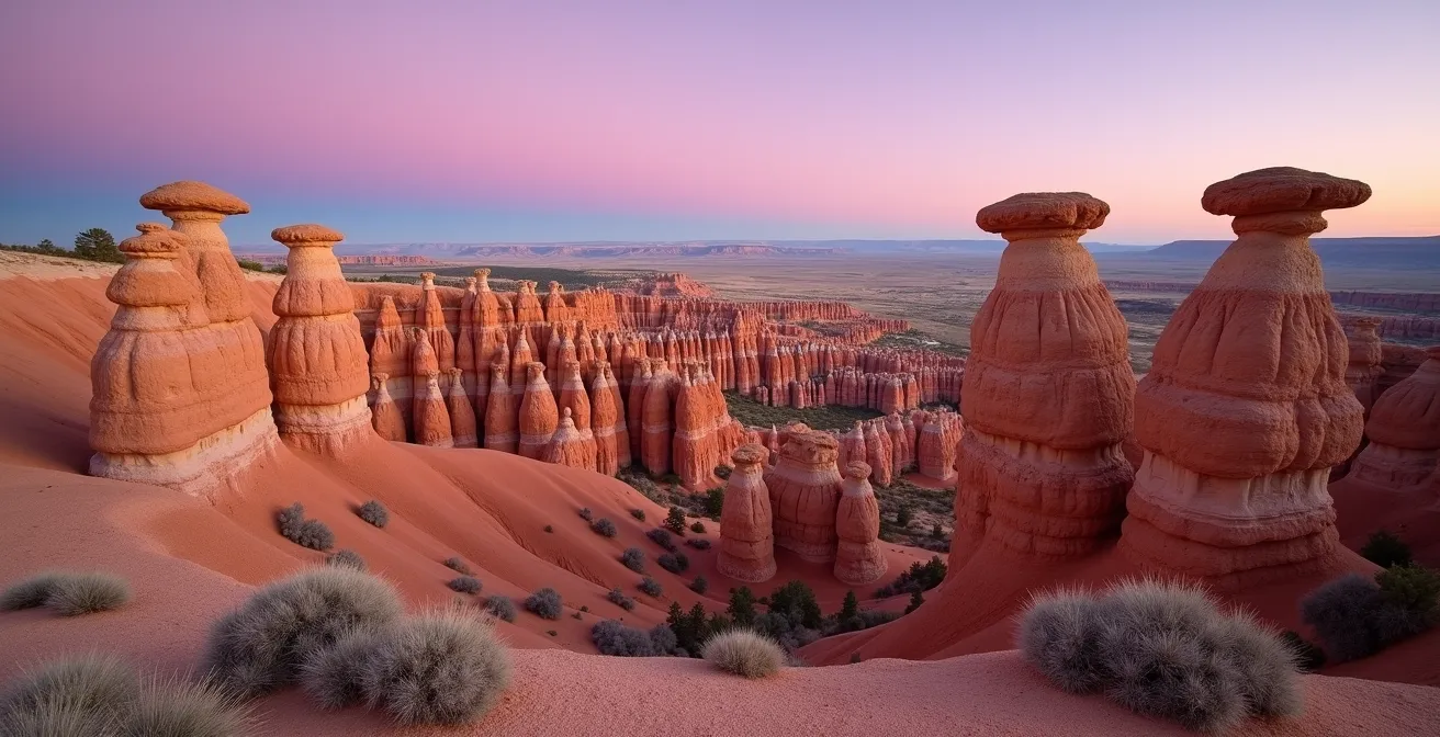
From a geomorphologist’s perspective, the dramatic appearance of hoodoos is a function of light interacting with topography. The most compelling moments for observation and photography occur during the “golden hours”—the first hour after sunrise and the last hour before sunset. During these times, the sun is low in the sky, casting long, deep shadows that sculpt the landscape in a way that midday sun cannot.
This low-angle light is critical for revealing the texture and form of the hoodoos. It rakes across the sandstone surfaces, highlighting the intricate horizontal banding of the sedimentary stratigraphy and the subtle patterns of erosion. The verticality of the pillars is exaggerated, and the caprocks often seem to glow as they catch the warm, direct light while the bases are cast in cool, blue-toned shadows. Midday sun, by contrast, is high and direct, which tends to flatten the landscape, bleach out color, and eliminate the dramatic shadows that give the badlands their depth and character.
The evening light, in particular, can be spectacular in the Red Deer River Valley. As the sun sets, the iron-oxide in the caprocks and surrounding soil can take on an intense reddish-orange hue, creating a powerful contrast against the darkening sky. This is not merely an aesthetic effect; it is a visual manifestation of the area’s geology, where the mineral composition of the rock layers is painted across the landscape by light.
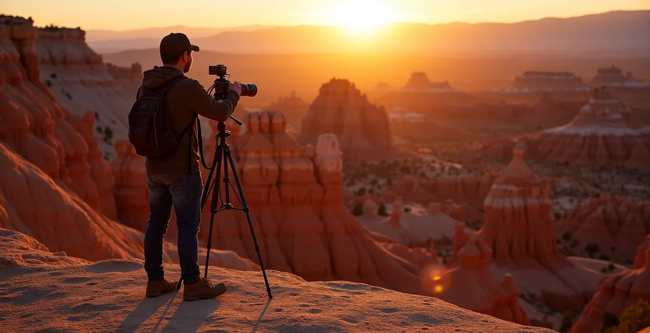
As this image demonstrates, the interplay of light and shadow transforms the hoodoos from simple geological forms into a dynamic and dramatic spectacle. The long shadows create leading lines that draw the eye through the scene, emphasizing the scale and otherworldly nature of the badlands. For the curious traveler, timing a visit to coincide with these periods of differential illumination provides a far richer and more memorable experience of the landscape’s geological artistry.
Blackfoot Legends: What Do Hoodoos Represent in Indigenous Stories?
To the Blackfoot (Siksika) Nation, the hoodoos of Southern Alberta are not merely geological curiosities. They are sacred entities, imbued with spirit and profound cultural meaning. In the Blackfoot worldview, the landscape is alive, and features like the hoodoos, particularly at sacred sites like Áísínai’pi (Writing-on-Stone Provincial Park), are seen as petrified giants or guardians. They are physical markers of a spiritual world that is deeply intertwined with the physical land.
According to legend, these figures provide protection to the living and watch over the spirits of the ancestors. They are not objects to be observed but beings to be respected. This perspective fundamentally changes the act of visiting. It transforms it from a tourist activity into an act of entering a sacred space, akin to stepping into a cathedral. The hoodoos serve as silent witnesses to ceremonies, stories, and millennia of human history etched into the surrounding cliffs.
Writing-on-Stone Provincial Park (Áísínai’pi) as a Sacred Blackfoot Site
Writing-on-Stone Provincial Park represents a sacred landscape for the Blackfoot Nation where hoodoos serve as both the physical setting for spiritual events and guardians of North America’s largest concentration of Plains rock art. The site’s deep spiritual significance transforms these geological formations from mere natural wonders into living elements of Blackfoot worldview and cultural heritage, demanding the utmost respect from all visitors.
This sacred connection is inseparable from the physical rock art found at these sites. As the organization Nature Alberta points out, the landscape and the culture are one. The hoodoos stand guard over a library of history and spirituality carved in stone.
The cliffs also provide the canvas for some of the most significant rock art in the North American Plains in a sacred area, central to the Blackfoot people.
– Nature Alberta, Bad But Beautiful
Understanding this context is vital for any visitor. The hoodoos are not an empty, wild landscape; they are a cultural touchstone. Recognizing them as sentient guardians, as the Blackfoot do, encourages a deeper form of respect that goes beyond “leave no trace” and moves towards a genuine reverence for both the land and its ancestral stories.
Exploring Hoodoos in Snow: Is the Trail Safe in January?
A winter visit to the Alberta badlands offers a stark and beautiful perspective, but it requires significant preparation and an understanding of specific geological hazards. While the trails may be technically open, their safety in January is highly conditional. The primary challenge is not the cold itself, but the interaction of moisture with the region’s unique clay soil. The landscape is dominated by bentonite clay, a material notorious for becoming exceptionally slick and treacherous when wet or frozen.
Even a thin layer of snow or morning frost can transform a manageable incline into a dangerous, impassable slide. Therefore, proper traction is non-negotiable. Ice cleats or microspikes are essential equipment for any winter hike in the badlands. Furthermore, the limited daylight, often around just 8 hours in January, demands careful planning to avoid being caught on the trail after the early sunset. A headlamp is a critical piece of safety gear, even for a day hike.
Winter also brings the geological process of cryofracturing, or frost wedging, into sharp focus. Water seeps into cracks in the sandstone during the day and freezes at night, expanding and exerting immense pressure that breaks the rock apart. While this is a key part of the natural erosion cycle, it can increase the risk of rockfall, especially during freeze-thaw cycles. Hikers should remain vigilant and avoid lingering directly beneath large pillars or unstable-looking cliffs. To manage these conditions, hikers must carry specific gear:
- Ice cleats or microspikes for traction on frozen bentonite.
- Insulated water bottles to prevent freezing.
- Multiple insulation layers to manage temperature changes.
- Emergency supplies, including extra food and a first aid kit.
- A headlamp due to early sunset conditions.
A winter exploration is rewarding for the prepared, but it is unforgiving to the complacent. Safety is contingent on having the right equipment and a profound respect for the amplified challenges of the winter badlands environment.
Drumheller vs Writing-on-Stone: Which Hoodoo Site Should You Visit?
Choosing between Drumheller and Writing-on-Stone Provincial Park for a hoodoo-viewing excursion depends entirely on your primary interest: geological spectacle or cultural immersion. While both feature stunning badlands topography, they offer fundamentally different experiences. Drumheller is the more accessible and family-friendly option, centered on impressive geological formations and the world-renowned Royal Tyrrell Museum of Palaeontology.
The hoodoos near Drumheller are easily accessible via paved paths and viewing platforms, making it an ideal choice for those with limited time or mobility. The focus is largely on the science of geology and paleontology. It is a destination of discovery, where the land’s deep history is presented through fossils and dramatic landscapes. Services and amenities are plentiful, with numerous hotels and restaurants in the town.
Writing-on-Stone/Áísínai’pi, a UNESCO World Heritage Site, offers a much deeper, more spiritual journey. While it has beautiful hoodoos, its global significance lies in it being the site of the largest concentration of First Nation petroglyphs (rock carvings) and pictographs (rock paintings) on the Great Plains. Access to the most significant rock art is restricted to guided tours to protect the fragile carvings. The experience is one of cultural pilgrimage. It is a place to learn about the spiritual connection between the Blackfoot people and the land. Services are limited primarily to camping, requiring visitors to be more self-sufficient.
The following table, based on information from regional travel guides like Visit Calgary, breaks down the key differences to help you make an informed decision. This comparison is sourced from a comprehensive analysis of badlands road trips.
| Feature | Drumheller | Writing-on-Stone |
|---|---|---|
| Distance from Calgary | 135 km (1.5 hours) | 210 km (2.5 hours) |
| Main Attraction | Geological formations & Royal Tyrrell Museum | Rock art & spiritual significance |
| Accessibility | Paved paths, easy access | Guided tours required for rock art |
| Services | Hotels, restaurants, full amenities | Camping, limited services |
| Best For | Families, geology enthusiasts | Cultural pilgrimage, spiritual seekers |
Down and Up: How Tough is the Hike Out of Horseshoe Canyon?
The hike into and out of Horseshoe Canyon, located just outside Drumheller, is deceptively strenuous. While the view from the upper platform is panoramic, descending into the canyon commits you to a challenging return climb that should not be underestimated. The hike involves a significant 70-meter (230-foot) elevation change, which is roughly equivalent to climbing 20 flights of stairs.
The difficulty, however, lies not just in the elevation gain but in the trail surface itself. The paths are composed almost entirely of bentonite clay. When dry, this surface is crumbly and can be slippery underfoot. But the true hazard emerges when it’s wet. After a rain shower—a common occurrence during Alberta summers—the bentonite transforms into an impassably slick, glue-like mud that clings to boots in heavy clumps, making each step an exhausting effort. Attempting the climb in wet conditions is not only difficult but dangerous.
The return ascent is a true test of cardiovascular fitness. There is little to no shade within the canyon, and on a hot summer day, the sun reflecting off the pale clay can create intense heat. Hikers must carry an ample supply of water. The climb is steep and sustained, requiring a steady pace. For those unaccustomed to hiking on variable terrain or with a lower level of fitness, the ascent can be grueling. It’s essential to plan for the climb out; the easy descent can lull one into a false sense of security.
Ribbon Skirts and Photography: What is Respectful at a Cultural Site?
Visiting a location as sacred as Writing-on-Stone/Áísínai’pi requires a shift in mindset from that of a tourist to that of a respectful guest. This is especially true concerning photography and personal conduct. The site is an active place of cultural and spiritual importance for the Blackfoot people. What may seem like an innocent photo can be a profound act of disrespect if it violates cultural protocols or site regulations.
The primary consideration is the protection of the rock art. As a matter of preservation and respect, all photography of the petroglyphs and pictographs must be done without flash. The intense light from a flash can damage the ancient pigments and lichens over time. Furthermore, touching the rock art is strictly forbidden, as oils from human skin can cause irreparable harm. These regulations are in place to protect a priceless and irreplaceable historical and spiritual record.
Photography Restrictions at Writing-on-Stone Provincial Park
The archaeological site at Writing-on-Stone enforces strict visitor controls, including a ban on flash photography and any physical contact with petroglyphs, to protect the invaluable rock art. These rules acknowledge the site’s dual role as both a scientific treasure and a sacred Blackfoot cultural landscape, with vigilant monitoring ensuring its preservation for future generations.
Beyond the official rules, cultural sensitivity is paramount. One should never photograph people, especially if they appear to be engaging in prayer or ceremony, without their explicit permission. A ribbon skirt, for example, is a piece of sacred regalia for many Indigenous women, not a costume. Photographing someone wearing one without consent is intrusive. The focus of photography should be on the landscape, not on capturing cultural activities as a spectacle. Drones are also prohibited in all Alberta Provincial Parks to maintain the tranquility and sacred atmosphere of these sites.
Action Plan: Respectful Photography at a Cultural Site
- Always ask for explicit permission before photographing any person.
- Never use flash photography near rock art or within sacred areas.
- Strictly adhere to ‘no drone’ regulations within Alberta Provincial Parks.
- Stay behind all barriers and respect any areas marked as closed to the public.
- Focus your lens on landscapes rather than attempting to capture ceremonial activities.
Key Takeaways
- Hoodoos are temporary geological features defined by a balance of erosion and resistance, not permanent statues.
- Human impact (anthropic pressure), especially off-trail foot traffic, is the primary factor accelerating their decay.
- Respectful visitation, guided by scientific understanding and cultural awareness, is a form of active preservation.
Driving the Dinosaur Trail: How to Complete the North and South Loops?
The Dinosaur Trail is a 48-kilometre scenic loop that serves as a perfect capstone experience, encapsulating the geology, history, and grand scale of the Drumheller Valley. Completing the full loop provides a comprehensive overview of the badlands landscape, from sweeping vistas to intimate views of the Red Deer River. The most effective way to drive the trail is to start in Drumheller and head west, following the North Dinosaur Trail (Highway 838).
This northern section takes you past the world-famous Royal Tyrrell Museum and leads to the historic Bleriot Ferry. This cable-operated ferry is one of the last of its kind in Alberta and offers a unique river-crossing experience (note: it operates seasonally, typically from May to September, so check its status before you go). After crossing the river, the route continues back east along the South Dinosaur Trail (Highway 575), completing the loop.
A Strategic Dinosaur Trail Itinerary
An optimal route for the 48km Dinosaur Trail loop begins in Drumheller, proceeds west along the North Dinosaur Trail (Highway 838), crosses the river on the historic Bleriot Ferry (check for seasonal operation), and returns via the South Dinosaur Trail (Highway 575). This itinerary ensures you experience key viewpoints like the Orkney Viewpoint, which offers a dramatic perspective on badlands erosion in action.
A key stop on the southern loop is the Orkney Viewpoint. This lookout offers a breathtaking panorama of the Red Deer River Valley, revealing the immense scale of erosion. From here, you can see nascent hoodoos forming and observe the powerful geological forces at work. It is at viewpoints like this that the rate of disappearance becomes tangible. Scientific measurements in the Red Deer River valley have recorded the rapid erosion rate at 1-2 centimeters per year. Driving the Dinosaur Trail is more than a scenic tour; it is a mobile lesson in geomorphology, allowing you to witness both the creation and destruction that define the badlands.
By approaching Alberta’s badlands with this deeper understanding, your visit transforms from a simple trip into a meaningful engagement with a living, changing, and culturally significant landscape. The next logical step is to plan a journey that is not just scenic, but scientifically informed and profoundly respectful.