
Navigating Highwood Pass safely is not about your driving skill, but your technical understanding of its unique, high-altitude environment.
- Weather is not random; it’s a predictable effect of elevation called orographic lift, which can cause sudden snow even in summer.
- Wildlife encounters require strict protocols, not passive observation, especially with protective mother elk in late spring.
Recommendation: Before your trip, your priority is a full system integrity check of your vehicle, focusing on tires, fluids, and an emergency kit built for potential overnight stranding without cell service.
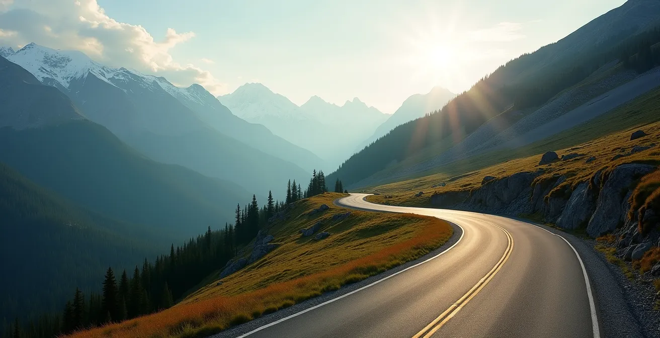
The initial ascent on Highway 40 can be deceiving. The road is well-maintained, the grade manageable. Yet, for many drivers, a knot of anxiety tightens with every metre gained. You’ve heard the stories: sudden snowstorms in July, wildlife on the road, the sheer isolation. The common advice—”check the weather” or “drive carefully”—feels inadequate for the reality of piloting a vehicle at over 2,200 metres. This unease stems not from a lack of driving ability, but from a gap in technical knowledge about how such an extreme environment functions.
This is not a typical tourist guide. Consider this your pre-drive technical briefing. As a mountain driving instructor, my objective is to replace your anxiety with operational knowledge. We will not just look at the what, but the ‘why’ behind every potential hazard. The key to mastering Highwood Pass is not found in a scenic pullout guide, but in understanding the physics of its weather, the predictable behaviours of its wildlife, and the non-negotiable logic of vehicle preparedness. It is about shifting your mindset from that of a passenger to that of a confident, informed operator in a dynamic system.
This guide will systematically deconstruct the operational challenges of the pass. We will cover the specific reasons for its seasonal closure, the meteorological principles at play, and the precise protocols for navigating wildlife encounters. By the end, you will have the technical framework to drive the highest paved road in Canada not just with caution, but with true competence.
This detailed briefing is structured to build your operational knowledge progressively. Below is the table of contents covering each critical system and procedure for your drive.
Table of Contents: A Technical Guide to Mastering Canada’s Highest Road
- Why is Highway 40 Closed Until June 15th Every Year?
- Sentinel Pass: Is the Switchback Slog Worth the View of Ten Peaks?
- Why is it Raining in the Valley but Snowing at the Pass?
- Cycling Highwood Pass: How to Prepare for 700m of Elevation Gain?
- Where to Stop on the Kananaskis Trail to See Sheep?
- Blankets and Candles: What Must Be in Your Trunk Even in Summer?
- May and June Danger: Why Are Mother Elk More Aggressive Than Bears?
- Highway 22 Guide: Why Choose the Cowboy Trail Over the QE2 Highway?
Why is Highway 40 Closed Until June 15th Every Year?
The annual closure of Highway 40 through Highwood Pass is a common point of confusion for visitors planning a spring trip to the Alberta Rockies. The gates are locked not primarily due to impassable snow depth—as crews can often clear the road earlier—but as a critical wildlife management strategy. The period from December 1 to June 14 is a mandatory closure that creates an undisturbed sanctuary for the region’s fauna during their most vulnerable period: the spring birthing season. This specific timeframe allows bighorn sheep, elk, moose, and grizzly bears to use the entire valley, including the road corridor, for migration and raising their young without the stress and danger of vehicle traffic.
This policy has a significant implication for trip planning. The hard opening date of June 15th (conditions permitting) is a major event, drawing large crowds. If you plan to visit on opening weekend, booking accommodations in nearby towns like Longview or Canmore well in advance is essential. For cyclists, the closure period offers a unique window of opportunity. Typically, in the first two weeks of June, the road is cleared of snow but remains closed to vehicles, creating a world-class, car-free cycling experience. However, this also means you are entering a space where wildlife is abundant and unaccustomed to human presence, requiring a higher state of alert.
Understanding the closure is the first step in respecting the operational environment of the pass. It is a managed wilderness area where ecological integrity takes precedence over traffic flow. This principle should inform every decision you make while traveling through it.
Sentinel Pass: Is the Switchback Slog Worth the View of Ten Peaks?
A frequent point of confusion for hikers planning a trip to the Highwood Pass area is the trail to Sentinel Pass. It is critical to understand from a planning perspective that Sentinel Pass is not located in Kananaskis Country or accessible from Highway 40. It is a famous, and often crowded, hike located in Banff National Park, with its trailhead near Moraine Lake. The confusion arises because both are high-altitude Rocky Mountain passes renowned for their spectacular larch tree displays in autumn. Attempting to find the Sentinel Pass trailhead from Highwood Pass will result in failure and lost time.
However, for those seeking a similar high-reward hiking experience directly accessible from Highwood Pass, the premier alternative is the Pocaterra Ridge trail. This hike is arguably one of the most spectacular in the entire Canadian Rockies, especially during the larch season in late September. The trailhead is located directly at the summit of Highwood Pass, making it an efficient and logical objective for your trip. The trail follows a dramatic ridge, offering panoramic views and an immersive experience with the golden larches that is considered world-class. It provides the same type of visual reward—alpine vistas and vibrant autumn colour—that hikers seek at Sentinel Pass, but within the Kananaskis ecosystem.
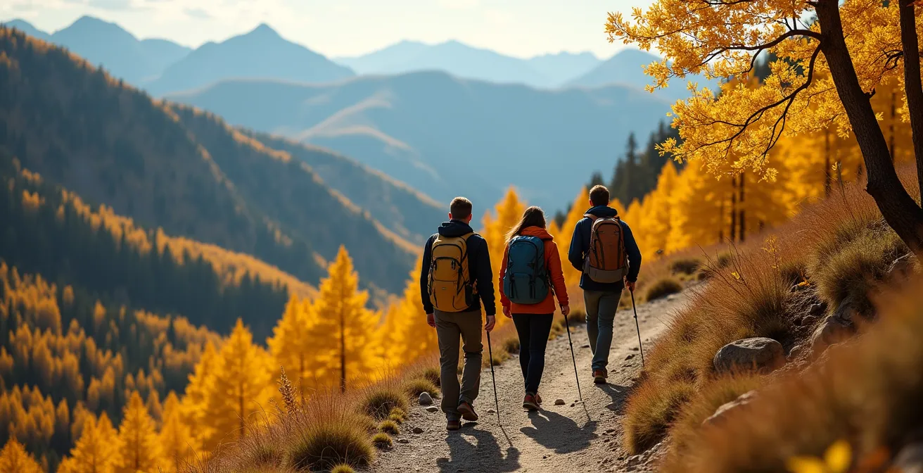
As this image illustrates, the experience on Pocaterra Ridge is one of deep immersion in the alpine environment. Choosing this hike allows you to fully leverage your visit to Highwood Pass without the logistical complication of traveling to a different national park. From an operational standpoint, focusing your hiking plans on trails originating from Highway 40, like Pocaterra Ridge, is the most efficient and contextually appropriate strategy.
Why is it Raining in the Valley but Snowing at the Pass?
The most disorienting experience for a driver on Highwood Pass is the rapid, and often dramatic, change in weather. Leaving the sunny foothills near Longview, it’s common to encounter rain in the Kananaskis valley, only to find heavy, wet snow at the summit. This is not a random phenomenon; it is a predictable meteorological principle known as orographic lift. As moist air from the west is forced upwards over the mountain range, it cools, condenses, and releases its moisture. The summit of Highwood Pass sits at an elevation of 2,217 metres (7,273 feet), an altitude high enough to ensure that this precipitation frequently falls as snow, even when temperatures in the valley are well above freezing.
A temperature difference of 10-15°C between the valley and the summit is not uncommon. This means a pleasant 18°C day in Canmore can translate to a 3°C snow or sleet event at the pass. Relying on a standard town or city forecast is a critical error. You must consult elevation-specific forecasting tools and real-time data sources to have an accurate operational picture of the conditions you will face. This is a non-negotiable step in your pre-drive checklist. Failure to do so means you are driving blind into a potentially hazardous situation, from reduced visibility to slick, slushy road surfaces.
Your Action Plan: Real-Time Weather Verification
- Check Alberta 511 road cameras for a live visual of conditions at the pass summit before you commit to the drive.
- Visit the Friends of Kananaskis website for a curated list of live weather links specific to the Highwood Pass area.
- Use a service like Mountain-Forecast.com, which provides forecasts for specific elevations, not just the valley floor.
- For the most current human-verified information, call the Barrier Lake Information Centre at 403-678-0760.
- Monitor forecasts for both Longview (south) and the Kananaskis Valley (north) to understand the full spectrum of potential conditions.
Cycling Highwood Pass: How to Prepare for 700m of Elevation Gain?
For cyclists, Highwood Pass represents one of the most iconic and challenging climbs in Canada. The preparation for this ride is a technical exercise in understanding grade, distance, and energy output. There are two primary approaches to the summit, each presenting a distinct physiological and logistical challenge. The choice between them should be a deliberate one, based on your experience and objectives. The steeper, shorter route from the north gate is a pure power climb, while the longer, more gradual ascent from the south demands endurance.
The “Gate-to-Gate-to-Gate” (G2G2G) is the ultimate test for the most dedicated riders. As documented by cycling enthusiasts, this 110 km journey with 1,609m of total elevation gain involves starting at one winter gate, riding to the summit, descending to the opposite gate, and then returning over the pass to the start. It’s a monumental day of cycling that requires significant training and logistical support. Many, including the Highwood Cycle Club, organize group rides specifically for this challenge in the car-free window before June 15th, underscoring its status as a benchmark of cycling fitness.
For any cyclist attempting the pass, understanding the technical differences between the two ascents is crucial for a successful and safe ride. The following data provides the necessary information for strategic planning.
| Route Aspect | North Gate (King Creek) | South Gate (Longview) |
|---|---|---|
| Distance to Summit | 17 km | 37.5 km |
| Average Grade | 3.6% (Category 1 sections) | 2% average (gentler) |
| Elevation Gain | 508m | 663m |
| Time to Summit | 1.25 hours (strong riders) | 3.5 hours |
| Best For | Experienced cyclists seeking challenge | Longer endurance ride with gradual climb |
Where to Stop on the Kananaskis Trail to See Sheep?
The question of where to see wildlife, particularly bighorn sheep, on Highwood Pass needs to be reframed from a safety perspective. The goal is not simply to “spot” animals, but to do so without creating a hazard for yourself, other drivers, or the wildlife. The primary reason for the extended seasonal closure is to protect wildlife during their critical migration and birthing seasons. When the road opens, you are a guest in their habitat. Therefore, your behaviour must be governed by strict safety protocols, not tourism impulses.
Bighorn sheep are frequently seen along the roadside, especially near the summit and on the southern portion of the pass, where they are attracted to natural mineral deposits. This predictable behaviour often leads to “wildlife jams,” where multiple vehicles stop, creating a dangerous situation on a narrow road with limited shoulder space. Stopping your vehicle in a live lane of traffic is a serious violation and incredibly risky. You must only use designated, paved pullouts to observe wildlife, and even then, staying inside your vehicle is the safest protocol. Conservation Officers patrol the pass, particularly on busy weekends, and will enforce these rules.
Adhering to correct wildlife viewing procedure is not optional; it is a core component of driving this route safely. The following guidelines are your operational standard:
- Use Designated Pullouts Only: Never stop on the road itself. If there is no safe, designated place to pull over completely, you must continue driving.
- Stay in Your Vehicle: This protects you and reduces stress on the animal. Use a zoom lens for photos rather than approaching on foot.
- Be Aware of ‘Wildlife Jams’: Be prepared for sudden stops from vehicles ahead. Maintain a safe following distance and be ready for the presence of Conservation Officers directing traffic.
- Avoid Driving at Twilight: Dawn and dusk are when wildlife is most active and visibility is lowest, creating the highest risk for collisions.
Blankets and Candles: What Must Be in Your Trunk Even in Summer?
Preparing your vehicle for Highwood Pass is not about planning for what is likely; it’s about being equipped for what is possible. A mechanical issue, a flat tire, or a sudden road closure can strand you for hours in an area with zero cell phone service. Even in August, nighttime temperatures at the summit can drop close to freezing. Your emergency kit must be built for an unsupported, overnight scenario. The inclusion of items like wool blankets is not an over-precaution; it is a pragmatic response to the environment’s realities.
The most common cause of stranding is tire failure. The road surface is generally good, but shoulders can have sharp rocks. A full-size spare tire and the tools and knowledge to change it are non-negotiable. A simple tire inflator that plugs into your vehicle’s 12V outlet can be the difference between a minor delay and a multi-hour wait, allowing you to slowly reach a service area with a slow leak. Similarly, a satellite messenger like a Garmin inReach or SPOT is the only reliable way to call for help. Relying on your cell phone is a critical system failure.

Your trunk should contain a complete survival system. This is your personal responsibility as the vehicle operator. The following items constitute the minimum baseline for a drive over Highwood Pass:
- Full-size spare tire, jack, and lug wrench (and the knowledge of their use).
- 12V tire inflator.
- Wool blankets or a sleeping bag rated for low temperatures.
- A satellite communication device (e.g., inReach, SPOT).
- A physical copy of the Backroad Mapbook for Kananaskis Country.
- Extra water and non-perishable food sufficient for an 8-12 hour period.
- A valid Kananaskis Conservation Pass, purchased online *before* you lose cell signal upon entering the area.
May and June Danger: Why Are Mother Elk More Aggressive Than Bears?
While grizzly and black bears command a great deal of attention, from a risk-assessment standpoint, the most immediate and statistically more probable threat to your safety in late spring (May and June) comes from mother elk (cows). During the calving season, which coincides with the pre-opening cycling period and the weeks just after, cow elk are fiercely protective of their newborn calves. They perceive anything that gets too close—a hiker, a cyclist, or even a vehicle that has stopped—as a direct threat. Unlike bears, which often display a desire to avoid humans, a protective elk cow is more likely to charge and attack.
The safety protocol in this situation is absolute: maintain distance and do not stop. If you are cycling and see a bear eating dandelions in a ditch, you must continue past without stopping. When every cyclist stops to take a picture, the animal becomes habituated and eventually aggressive, leading to a situation where the bear may have to be destroyed by wildlife officers. The same principle applies with greater urgency to elk. If you see a calf, assume its mother is nearby and watching. You must immediately increase your distance. Putting a large object like a tree or your vehicle between you and an aggressive elk can de-escalate an encounter.
Carrying bear spray is a mandatory piece of personal protective equipment, and it is effective on other aggressive mammals, including elk and cougars. Know how to access it and use it. Your primary tool, however, is situational awareness and avoidance. Make noise while on trails to avoid surprising an animal. Check the Alberta Parks trail reports before heading out, as they will often post warnings about aggressive wildlife in specific areas.
Key Takeaways
- Highwood Pass is a dynamic system, not a static road; its weather and wildlife are governed by predictable, high-altitude principles.
- Your vehicle’s emergency kit is your primary life support system in a no-service zone; it must be equipped for an overnight stranding, even in summer.
- Wildlife safety protocols are about proactive de-escalation and maintaining distance, not passive observation, especially during the spring calving season.
Highway 22 Guide: Why Choose the Cowboy Trail Over the QE2 Highway?
Your approach route to Highwood Pass is a strategic decision that sets the tone for your entire trip. While the Queen Elizabeth II Highway (QE2) is the primary north-south artery in Alberta, choosing the slower, more scenic Highway 22—the Cowboy Trail—is the superior operational choice, particularly for accessing the south entrance of the pass. Coming from Calgary, taking Highway 22X west and then turning south onto Highway 22 leads you through the heart of Alberta’s ranching foothills, passing through towns like Black Diamond and Turner Valley before arriving in Longview.
This route is more than just scenic; it is a practical way to manage your mindset and vehicle. It avoids the high-speed, high-density traffic of the QE2, allowing for a calmer, more observant drive. From Longview, you head west on Highway 541, which seamlessly becomes Highway 40 as it enters Kananaskis Country. This provides a gradual transition from open ranchland into the foothills and finally into the mountains, allowing you to acclimatize to the changing road conditions and landscape. The entire Highwood Pass loop, whether starting from Calgary, Canmore, or Banff, is a significant undertaking; you should allow a minimum of four hours of driving time, not including stops.
Choosing the Cowboy Trail frames the journey not as a race to a destination, but as a deliberate progression into a more demanding environment. It is the proper ‘staging’ for the technical drive ahead, aligning your speed and attention with the conditions you are about to face. It is the professional driver’s choice.
Now that you have the technical knowledge, the next logical step is to perform a full systems check on your vehicle and emergency kit. Ensure your equipment and your mindset are prepared for the operational realities of Canada’s highest paved road.